
Modern technology didn't just spring up overnight; it often has roots reaching far into the past. The history of GPS navigation actually began during the cold war, marking several milestones in the subsequent decades. In terms of automobiles, GPS didn't break out of its niche status until the 2000s. The first consumer GPS devices were bulky and expensive, often costing thousands of dollars. They relied on a constellation of satellites launched by the U.S. Department of Defense for military purposes, which were later opened to civilian use. The accuracy was initially limited, but improvements in satellite technology and receiver chips made GPS feasible for everyday drivers.
In a significant moment for consumer GPS, Google Maps debuted in 2005 in the U.S., though there are now several Google Maps alternatives on Android. The navigation process couldn't be simpler: you search for a business name or enter an address, and a route is calculated with step-by-step instructions. Turn-by-turn voice guidance, real-time traffic updates, and points-of-interest integration have made GPS indispensable for millions. However, you might be surprised to learn that not only are paper maps and atlases still around, but they've actually experienced a bit of a renaissance in the last decade.
Vice president of Rand McNally, Kendra Ensor told USAToday that by 2015, the map making company began to see increases in the sale of Road Atlases. In the U.K., map maker Ordnance Survey saw a 144% uptick in custom paper map sales in 2020, then another 28% rise in 2021. Both AAA and Rand McNally continue to offer updated physical maps, with the former still making TripTik route books, which include custom printed directions. Lost signals and a more active navigation experience are just a few of the reasons why would anyone opt for this old-school approach.
A paper map can't lose signal
Travelers have relied on physical maps for thousands of years, but GPS has become the dominant option in the 21st century. According to a UTires.com survey, certain parts of the country, such as Bakersfield, CA, have more than 55% of respondents declaring they're extremely reliant on the technology. The problem is, while convenient, GPS requires you have a signal, whether it be through a mobile carrier or satellite. You can utilize offline GPS apps, however that's dependent on you downloading the information beforehand, when internet is available. It's also noteworthy that most navigation software, like Google Maps, downloads an entire route when you first start navigating, so if you lose signal along the way, you can keep going. But if you need to start navigating without internet, that's when you run into trouble. In remote areas like national parks, deserts, or mountainous regions, cellular coverage can be spotty or nonexistent. Satellite-based GPS receivers can still function for positioning, but without a data connection, the map tiles and routing algorithms may not update properly. This is where a paper map becomes an essential backup.
In early 2026, those residing in Moscow and St. Petersburg, Russia faced intermittent and even failing mobile internet across major swaths of the cities for days. Suddenly, smartphones couldn't access or run applications properly, with navigation being one of them. As a result, demand tripled for atlases and paper maps of these areas. This incident highlights the vulnerability of relying solely on digital connectivity. Even in developed countries, natural disasters can cripple communication networks. Hurricanes, earthquakes, and wildfires often knock out cell towers and power lines, leaving GPS users stranded without digital guidance. The 2021 Texas winter storm, for example, caused widespread power outages that disrupted internet and mobile services, forcing many to rely on old-fashioned maps to navigate treacherous roads.
In another more anecdotal instance, a couple traveling from Canada to North Carolina found themselves amidst the chaos of Hurricane Helene which knocked out several services including internet. Fortunately, they were able to navigate and guide several travelers out of the affected area using physical paper maps. Paper maps do not require batteries, data plans, or satellite signals. They are immune to cyberattacks, such as the 2017 WannaCry ransomware that disrupted systems worldwide, including some transportation networks. When the digital infrastructure fails, a paper map becomes a lifeline. Emergency preparedness experts consistently recommend keeping a physical map in your vehicle as part of a go-bag. This simple preparation can make the difference between being stranded and finding safe passage.
GPS navigates for you, and can limit perspective
One of the issues with a navigation app, is that it largely does the thinking for you. After selecting a destination, your role in the navigation process is simply following on-screen prompts. Conversely, a physical map keeps you more active in the navigation process and aware of your surroundings. When using a paper map, you must mentally rotate and align the map with the terrain, identify landmarks, and plan your route based on your current location. This active engagement exercises spatial intelligence and improves your sense of direction. Studies have shown that relying heavily on GPS can lead to a decline in navigational skills. A 2015 study published in the journal "Nature Communications" found that people who use GPS have more active hippocampus activity when navigating without it, but long-term reliance can actually shrink the hippocampus, a brain region critical for spatial memory.
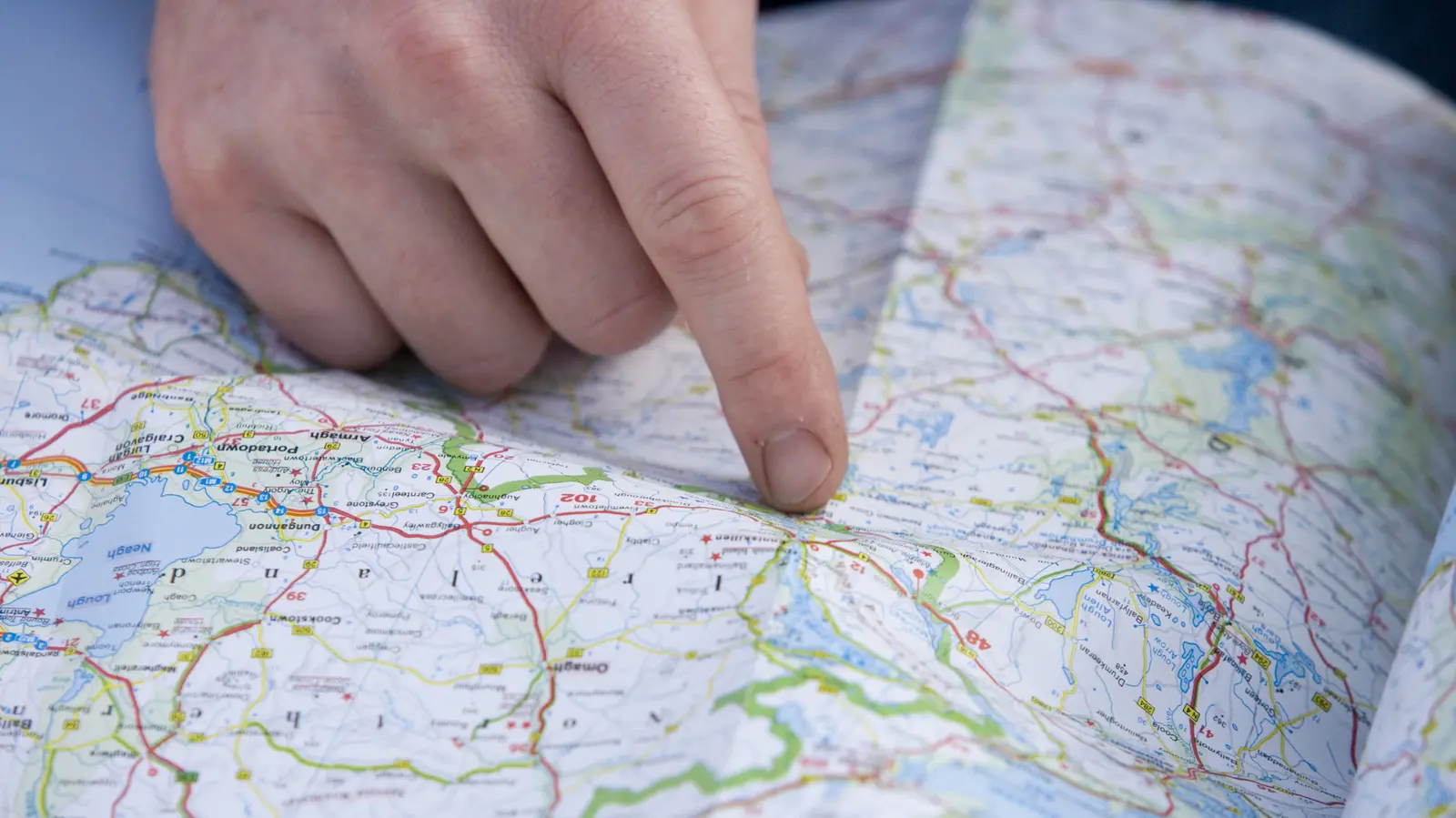
In addition, research has shown that the sensory experience of using a paper map helps the brain create a mental picture of the surrounding environment. The tactile act of folding the map, tracing a route with your finger, and seeing the topography in full color enhances memory retention. Old school maps also provide a much greater overall perspective, reaching well beyond your selected route. A paper atlas shows you entire states, major highways, secondary roads, rivers, parks, and points of interest. You can see alternative routes at a glance, identify scenic byways, and discover interesting towns that a GPS algorithm would never propose. This big-picture view fosters serendipity and exploration, encouraging travelers to take side trips and find hidden gems.
This "big picture" view can often be lost when using GPS in the car, which typically displays only the immediate area around your vehicle. If you must adjust your route using GPS, it can be more challenging on the go, as you may not understand where you're located in relation to other landmarks or your destination. For example, if an accident blocks your intended highway, a GPS recalculates and directs you to the nearest alternative. But without a mental map of the surrounding road network, you might end up on a convoluted detour when a simpler straight-line route exists. Paper maps allow you to anticipate such diversions by giving you the context to make informed decisions. Miller Edwards, a retired detective, explained to CBS News with regard to printed maps, "They give me a general idea of a larger area that I need to go to see. They have different cities and different points of view." This perspective is invaluable for professionals like first responders, delivery drivers, and truckers who need to navigate efficiently without constant digital prompts.
Moreover, paper maps have a cultural and aesthetic appeal that digital apps cannot replicate. Collecting vintage maps, antique atlases, and decorative cartography has become a hobby for many. Artists and designers use maps as inspiration, and schools encourage geography education with physical puzzles and globes. The resurgence of paper maps is not just about practicality; it's also about nostalgia and the joy of planning a trip on a table with a cup of coffee. Road atlases are still sold in gas stations and bookstores, and many drivers enjoy the ritual of spreading a map across the hood of their car. This tangible connection to the world is something that a smartphone screen cannot provide.
In the context of environmental sustainability, paper maps are often criticized for resource consumption, but digital maps also have a carbon footprint through data centers and device manufacturing. Some paper maps are now printed on recycled paper with soy-based inks, reducing their environmental impact. Conversely, relying on GPS requires a smartphone, which needs to be charged frequently and replaced every few years. The debate between digital and physical is nuanced, but the enduring presence of paper maps proves that innovation does not always mean outright replacement. As technology advances, the best approach might be a hybrid: using GPS for real-time traffic and turn-by-turn directions, but carrying a paper map as a reliable backup and a tool for exploration.
The resurgence of paper maps also aligns with the growing trend of digital minimalism. In an age of constant notifications and screen time, some travelers deliberately choose to disconnect by using analog tools. Camping, hiking, and off-grid adventures often demand paper maps for areas with no cell coverage. National parks provide trail maps that are far more detailed than standard GPS apps, showing contour lines, water sources, and backcountry campsites. Even urban explorers appreciate the charm of a fold-out map of a city, highlighting historical landmarks and local eateries that are not always featured in digital databases.
Finally, the human mind is wired to learn from physical interaction. Children who use paper maps develop better geography skills and memory retention compared to those who only use digital devices. Many schools still incorporate map-reading exercises in their curriculum to teach latitude, longitude, scale, and compass use. These foundational skills are crucial for understanding global events, interpreting news, and gaining a sense of place. By continuing to produce and use paper maps, we preserve a tradition that goes back centuries, ensuring that this knowledge is not lost in the digital age. The next time you plan a road trip, consider picking up a paper atlas along with your GPS. You might find that the journey becomes richer and more rewarding when you engage your brain in navigation, rather than passively following a robotic voice.
Source:SlashGear News